Why join ecorisQ?
At the heart of ecorisQ is a global community of dedicated professionals. By joining us as a member, you access a trusted network and transparent tools that support reliable natural hazard analysis.
Membership reflects your commitment to transparent hazard analyses and sustainable solutions, grounded in integrity, collaboration and scientific excellence.
- Details
The 2018 licence file for the ecorisQ tools E-Line, FINT, Rockyfor3D and SOSlope (coming before the end of 2017) are available for all members in the Tools menu (after login) and can already be be downloaded and used.
- Details
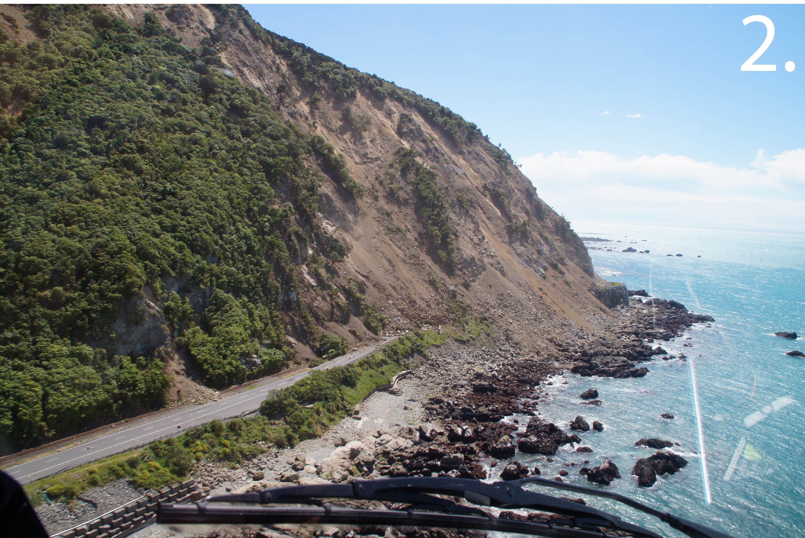
After 13 months closure due to landslides and rockfall from the magnitude-7.8 earthquake in November 2016, New Zealand State Highway 1 has opened today, with traffic again flowing north from Kaikōura. The crucial highway reconnects the major road route between Picton and Christchurch.

- Details
The ecorisQ association report 2016 was presented at the General Assembly 2017, which was organised on the 15th of november 2017 at the School of Agricultural, Forest and Food Sciences of the Bern University of Applied Sciences in Zollikofen, Switzerland. The number of members and member organisations increased from 190 in 2015 to 217 in 2016. The year report can be downloaded here.
- Details
Video of a spectacular rockfall in Switzerland in the community of Evolène (Valais).
As the local geologists said, the rock had been considered as fragile and was under observation. About 2000 cubic meters of rock finally toppled from a cliff, falling down into the valley. A few houses got evacuated and one road closed before although the rocks did not reach this infrastructure.
- Details
From 15 to 17 November 2016 the Rock Slope Stability Symposium 2016 (RSS 2016), will be organised in Lyon (France). RSS 2016 aims at gathering scientific and technical actors concerned by rock slope stability. Topics that will be treated are:
- Site investigation and rockfall hazard modelling
- Monitoring techniques
- Rockfall trajectory analysis
- Risk management
- Protection structures
- Case studies
More information can be found on the Symposium website
